

The Dark Side of the Northern Lights
The Dark Side of the Northern Lights
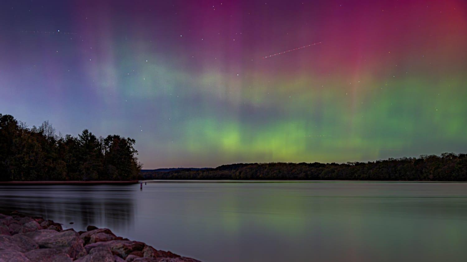
People throughout North America were treated to an incredible view of the aurora borealis for two nights in October 2024, stretching far enough south to be seen by those in Washington, D.C., and St. Louis. The pink, red and green lights streaking across the sky were caused by a large solar coronal mass ejection resulting in a strong magnetic storm. A day later, an X1.8-class flare was detected by at least six of the NGA's Global Navigation Satellite System, or GNSS, sites. While many Americans attempted to capture pictures on our phones, this flare was impacting navigation – increasing the level of radio noise to the point where Global Positioning Systems, or GPS, receivers have trouble effectively tracking the signal. When this happens, NGA’s Office of Geomatics must take action to prevent this from impacting its products.
As documented in a recently-published ION Navigation article, 30 years of maintaining WGS 84 with GPS , NGA has used GPS to provide trusted Positioning, Navigation, and Timing, or PNT, data for the World Geodetic System 1984 Terrestrial Reference Frame mission since 1994. When solar activity increases to the point that GPS measurements can be impacted, it becomes noticeable in the raw data processed by NGA’s GNSS Team. NGA uses these measurements to realize the WGS 84 TRF and, as stated on GPS.gov, provide the U.S. Space Force with data used in the GPS control segment. The raw data are also used daily in NGA to produce a publicly available GPS-precise orbit product, which can be used by surveyors to provide WGS 84 coordinates at any point in the world with an accuracy of just a few centimeters.
According to NGA’s Office of Geomatics’ William Konyk, solar activity can detrimentally affect a GPS or GNSS receiver’s ability to continuously track satellites and, as a result, affect anything that uses GNSS. However, the level of impact depends a lot on the level of accuracy required, type of receiver used and location on earth.
“Within our office, GPS measurements from a worldwide network of NGA-run GNSS monitoring stations are processed to realize, align and distribute the WGS 84 TRF,” said Konyk. “This NGA product represents the coordinate system to which all DOD maps, charts and geospatial intelligence is to be referenced.”
The loss of accuracy due to solar interference happens because the sun interacts with the ionosphere, a layer of the atmosphere that is essentially an unpredictable mass of plasma. This occurs when NGA's GNSS station in Alaska, a receiver near one of Earth's poles, experiences interference from high energy — charged solar winds that follow Earth's magnetic field lines and interact with the upper atmosphere. It also causes distortions in the ionosphere that make it difficult for receivers to accurately track the GPS signal. As a result, NGA has observed gaps in a receiver’s tracking data of the GPS satellites when solar storms occur.
Receivers located nearer to the magnetic equator are subject to different challenges. There, ultraviolet light combines with the direction of the magnetic field and energizes the ionosphere, and that energy is released after sunset and sunrise, causing the ionosphere to become very turbulent. These events can cause greater loss of tracking for GPS receivers than the northern latitude effect but they typically last only an hour or so after sunset.
While these events can be disruptive, GPS satellites transmit their signals on two different frequencies and most of the ionospheric effect can be removed. NGA developed internal solutions to provide timely data quality and environmental awareness assessments to identify and mitigate the impact of solar events.
GPS has been successful as a tool that creates an estimated billion dollars of value per day, but that success has disincentivized the creation of alternatives, should a contingency ever be needed. The U.S. has not built any secondary sources of PNT aside from GPS, but as part of the Resilient GPS Program, the Space Force recently awarded four companies a contract to design smaller and less expensive GPS satellites. These devices would transmit standard GPS messages, be capable of quick launches and could augment the current GPS constellation as needed. Still in it's early stages, the program aims to launch satellites by 2028.
Although large and small solar events can cause inconsistencies and errors in the GPS navigation system, it has not been significantly damaged. Even with the relatively large-scale solar flare seen last October, there was no significant impact to GPS because the system is designed to withstand substantially higher-powered disruptions. Whether the sun is noisy or well-behaved, NGA continues to contribute substantial data to command and control GPS, as well as serving as a center of excellence for GPS analysis and quality control.