

The Decisive Edge: How the Defense Mapping Agency Shaped the Gulf War
The Decisive Edge: How the Defense Mapping Agency Shaped the Gulf War
Thirty-five years ago, on Feb. 24, 1991, coalition troops began the Operation Desert Storm ground offensive, seeking to liberate Kuwait from Iraqi occupation.
Before the day was out, the Iraqi army was devastated — 10,000 troops were held as prisoners and a U.S. air base had been set up deep within Iraq’s borders. Within 100 hours, Iraq agreed to a cease-fire and pledged to honor peace terms.
Instrumental to this offensive — and efforts across the entirety of the Gulf War — was the Defense Mapping Agency, whose work marked a turning point for geospatial support.
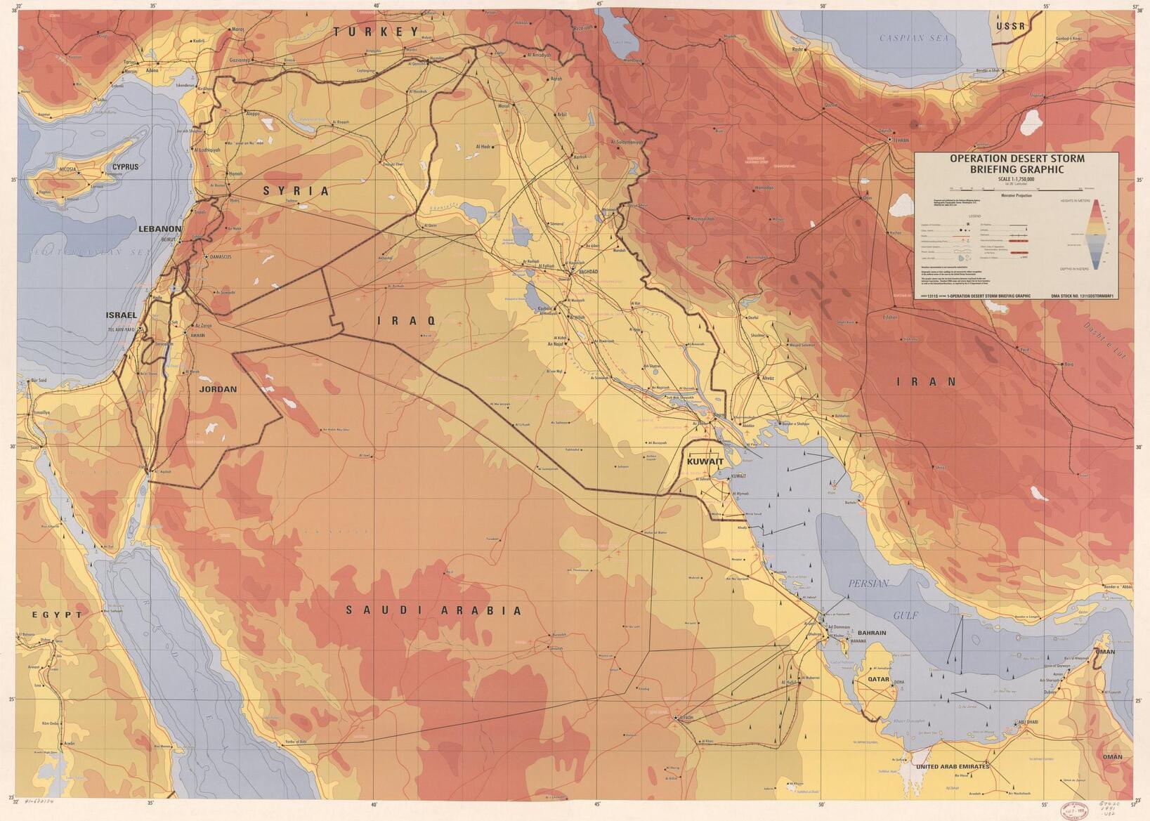
Prior to the Gulf War, maps of Kuwait, eastern Saudia Arabia and southern Iraq were largely based on data from the British colonial period. These existing products were rapidly becoming obsolete due to explosive growth in Kuwait and the surrounding areas, resulting in limited or non-existent coverage for military operations.
This deficiency led to the rapid re-targeting of space-based imagery platforms, which DMA analysts used to map the region at unprecedented speed, scope and scale.
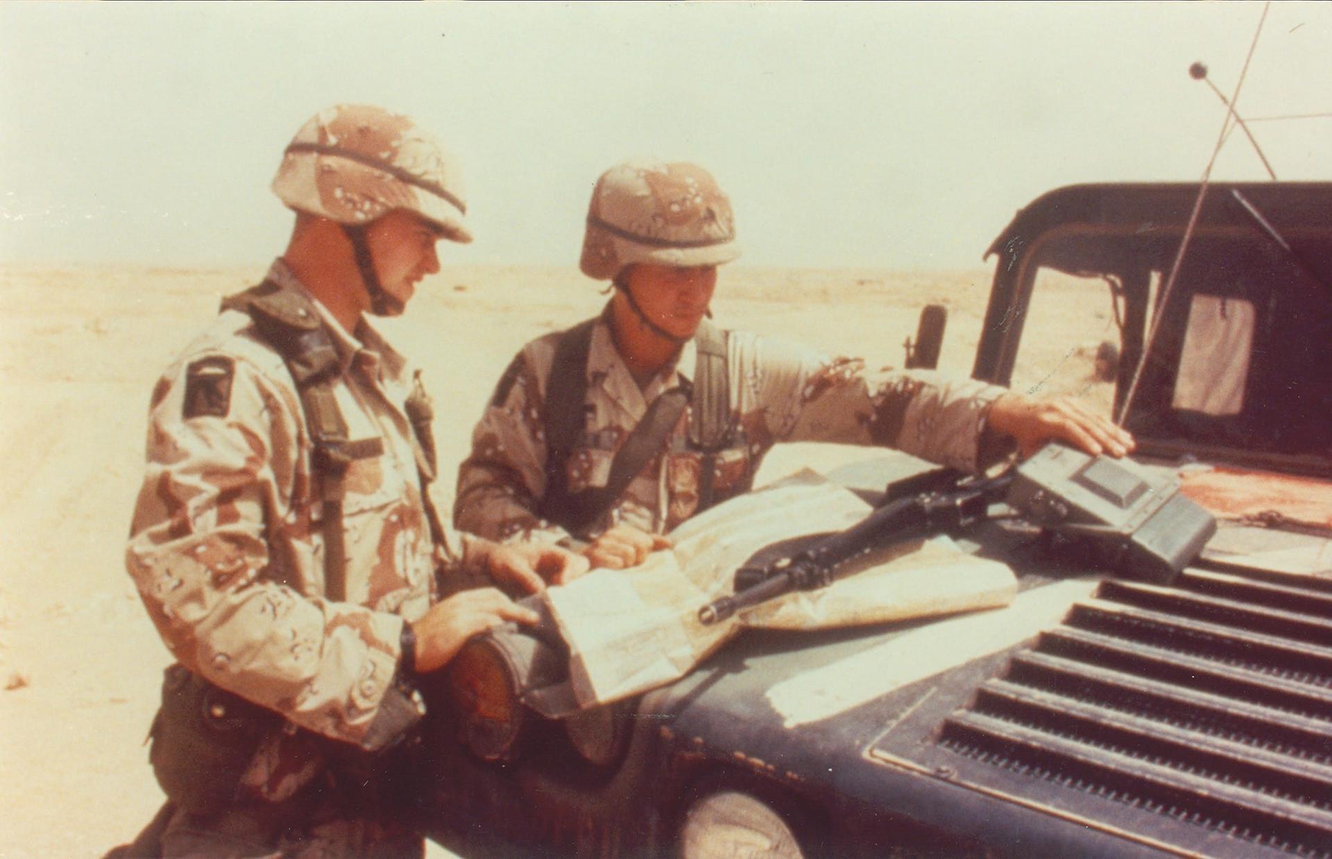
One core product was 1:50,000 scale Topographic Line Maps, which were key to ground operations. In response to the incredible demand for these products, DMA compressed its TLM production time from six months down to six weeks.
DMA was also instrumental in providing data that fueled the targeting of precision-guided missiles. The Gulf War marked one of the earliest major conflicts that saw widespread implementation of the weapons.
In past conflicts like the Vietnam War, commanders shouldered a difficult burden — the primary tools for decisive action, namely large-scale strikes and area bombing, were blunt instruments often resulting in widespread collateral damage.
The DMA-fueled precision-strike capabilities alleviated much of this burden, significantly reducing collateral damage and allowing commanders to quickly and decisively strike at Iraqi forces.
The agency’s impact reached beyond precision targeting, with DMA’s hydrographic and bathymetric products also proving to be critical to military and logistical operations.
Prior to the Gulf War, the U.S. Navy was uncertain of its ability to conduct extended carrier battle group operations in the confined waters of the Persian Gulf and Red Sea. Aided by DMA marine charts, the Navy was able to confidently deploy much closer to the Kuwait theater, boosting carrier effectiveness and increasing the range of the force’s cruise missiles. DMA products also supported amphibious assaults, counter-mine activities, and special operations.
When Saddam Hussein sabotaged an oil tanker facility, coastal hydrographic charts were used to plot and predict the advance of the oil slick, which posed an immediate environmental impact and operational threat.
Furthermore, 90% of all equipment and supplies entering the Gulf theater were delivered by sea — reliant not only on local charts, but global DMA maritime products.
DMA’s Operation Desert Storm Logistics Team comprised civilian and military members who prepared and shipped over 44 million map sheets in support of Operation Desert Storm. Due to the team’s attention to detail, dedication and teamwork, DMA was the only element that never lost a shipment during the conflict. Their work earned them a place in the GEOINT Hall of Fame, inducted in 2018.
The Gulf War demonstrated a fundamental shift in how warfare was conducted. The growing demand for satellite imagery, along with increased sophistication of modern weapon systems, created a direct dependency on precise geographic intelligence — a need DMA rose to meet, ultimately producing more than 1,900 unique maps and charts and printed more than 54 million paper maps.
DMA’s timely and detailed support for air, land and sea operations proved critical not only for the contingency planning of Desert Shield but for the successful execution of real-time combat in Desert Storm, cementing its vital role in a new era of warfare and creating a legacy that is carried on today by its successor, the National Geospatial Intelligence Agency.
This article is derived from “Charting the Storm: DMA’s Role in Operation Desert Shield & Desert Storm”, by Gregory S. Anderson. The full paper can be read here: https://apps.dtic.mil/sti/tr/pdf/ADA263957.pdf