

The 80th Anniversary of D-Day

The 80th Anniversary of D-Day
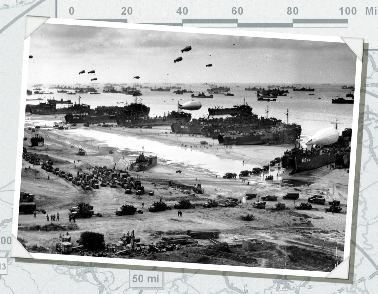
June 6, 2024, marks the 80th anniversary of the start of Operation OVERLORD, which was launched by the unprecedented D-Day landings on the beaches of Normandy. This operation concentrated the land, sea, and air forces of twelve allied nations in a high-stakes invasion of Nazi-occupied France. A successful invasion would significantly shorten the war by providing Allies with a foothold on mainland Europe. Failure would prolong the war indefinitely.
From the earliest days of planning to the hard-fought hours of embattled landings, maps were crucial to the intelligence gathering and execution of what would become the largest amphibious invasion in military history. National Geospatial-Intelligence Agency’s (NGA) predecessor organizations, particularly the Army Map Service (AMS), were at the center of this mapping effort.

When the United States entered World War II in 1941, the nation was ill-equipped to meet the wartime demand for military maps. In 1942, AMS was established with the mission to consolidate and innovate the nation’s military map-making, procurement, and supply efforts. In its early days, the map shortage facing AMS was so intense, the organization placed ads in popular magazines: “The War Department, Army Map Service, is seeking maps, city plans, port plans, place name lexicons, gazetteers, guide books, geographic journals, and geologic bulletins covering all foreign areas.”
From this humble beginning, the United States quickly redirected resources to meet the map shortage. By 1942, the U.S. government employed two out of every five geographers, drawing from the nation’s top geographic associations. By 1945, AMS was producing nearly 172,000,000 products and had collaborated with Allies to produce innovative, foundational GEOINT to support the joint war effort.
For the D-Day landings, AMS produced an estimated 69.9 million new or reproduced maps, incorporating more than two years of aerial photographic intelligence. Each new map required approximately 600 hours of cartographic labor, which meant AMS was operating 24 hours a day, employing a range of experts including language specialists, cartographers, artists, photographers, litho-engravers, and draftsmen.
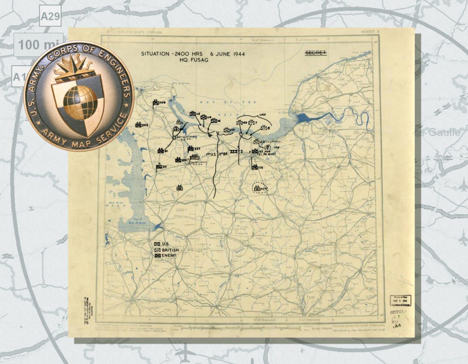
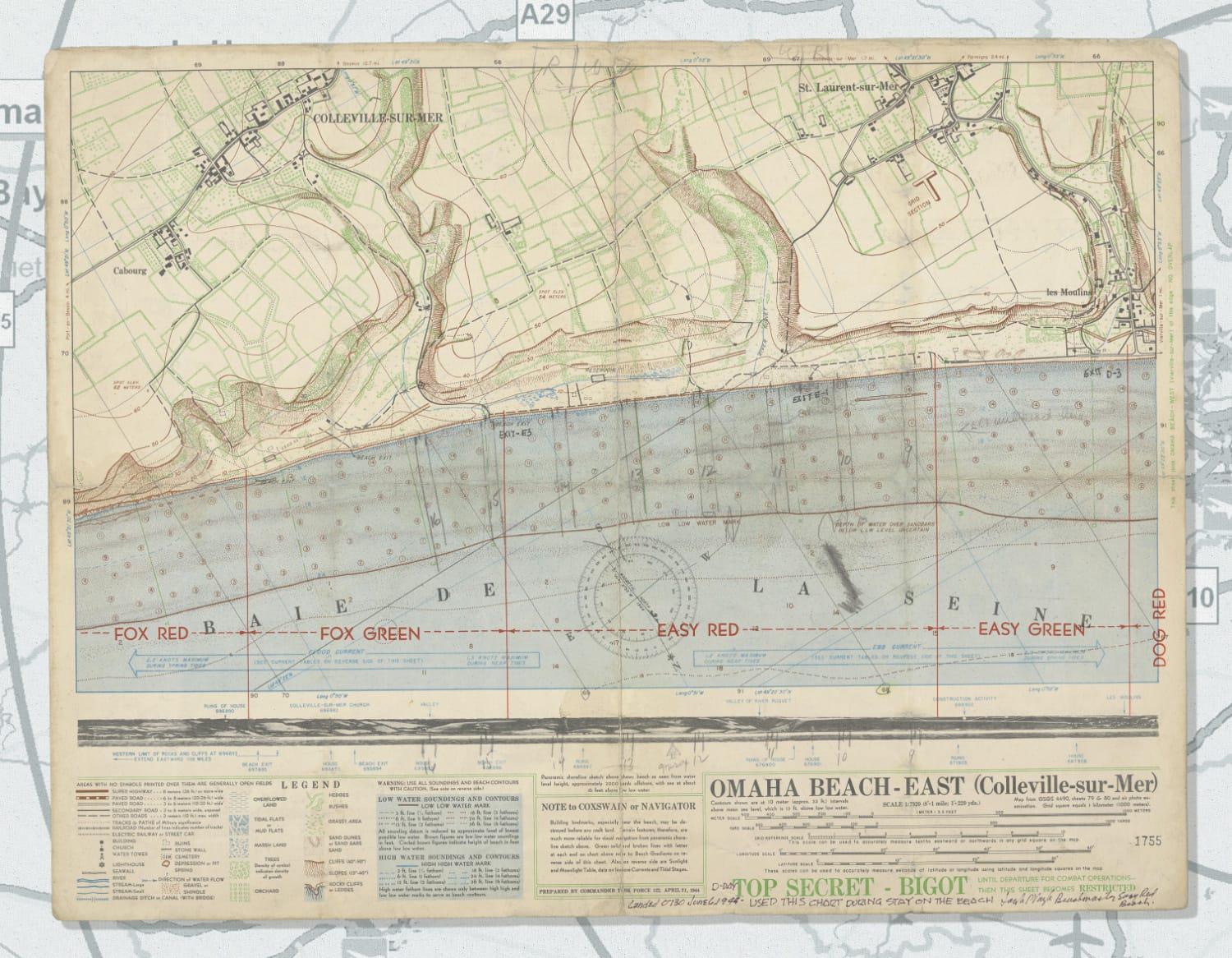
For the Americans attempting to make the harrowing landings of D-Day, the maps provided by organizations like AMS were a lifeline necessary to both operational success and personal survival. U.S. Navy Lt. Cmdr. Joseph Vaghi relied on this topographical map of Collevillesur-Mer while he served as a Beachmaster controlling the movement of troops from his position on Omaha Beach, considered by many to be the most difficult landing site of the invasion. In another sector of the invasion, the U.S. 12th Army Group annotated the below map to provide situational awareness of their end-of-day position and known German unit locations. The question marks around the location of the U.S. 101st Airborne Division illustrate the complexities of wartime intelligence. Following D-Day, situation maps like this one became a daily requirement.
Operation OVERLORD spanned 6-30 June, 1944. On D-Day, more than 6,000 Americans were killed, wounded, or missing in action. By the end of the campaign, an estimated 850,279 men, 148,803 vehicles, and 570,505 tons of supplies landed in Normandy. The city of Paris, occupied since June 14, 1940, was liberated shortly thereafter, and, in less than a year, the Allied forces crossed into Germany. By May 8, 1945, the war in Europe was over.